In the Geospatial Challenge Camp, the team was formed based on the different specialisations of the participants. In this case, the team was made up of three people: Jämsä, Chibuye and Issac Hsu. According to Jämsä and Chibuye, working together was easy from the beginning and their common communication style made it very straightforward to work together. Their idea for the final product was also born in a good team spirit.
“From the very beginning we decided that because we had so many ideas, we would have to vote for the best one. This was to make sure that we had a good basis and that everyone was really on board with the idea. That’s how we finally chose our topic,” Joha Jämsä recalls.
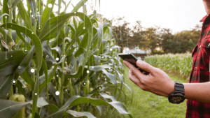
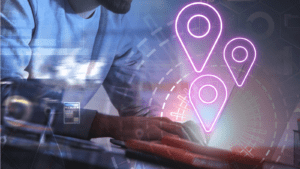
The solution the team developed during the 10-week challenge camp focuses on identifying the best routes for highly sensitive people to travel in cities, using optimised routes based on factors such as visual aesthetics and noise levels. It demonstrates the main idea of the challenge camp: using location-based data and technology to solve real-world problems. The tool demonstrates how existing open data sources can be used to design more inclusive cities for highly sensitive people, while improving the quality of life for everyone.
“I always think that for any kind of problem, there are endless possibilities of how to solve it. Every idea that comes up is worth exploring to see if it’s something that can actually be used to help people. There are so many ways to think innovatively and then create solutions that everyone else can benefit from,” says Chibuye.
From idea to action
The core idea of the Geospatial Challenge Camp is that you don’t just work with your own team, but the programme gives you the opportunity to work with highly qualified mentors and experts from different fields. The team found the help of the mentors very valuable.
“They pushed us forward. I remember having a really nice conversation with one of our mentors on the last day of the camp, giving us concrete ideas on what the next steps would be towards our vision. It really prepared us for the future,” recalls Joha Jämsä.
The road from idea to recognition wasn’t without its hurdles, and there were moments of doubt.
“I remember moments when I wasn’t sure about our idea, or even about myself. But as we worked together, we became more confident and more open to possibilities. Presenting our idea at the mid-seminar in Turku was a turning point,” says Gabriel Cibuye.

Verifying victory
The Geospatial Challenge camp ended in December 2023. The team had had a successful three months, but what now? During the camp they had a clear schedule with clear goals and everything was organised. Now they had to decide whether to continue developing their solution on their own.
“And all three of us decided to stay and we agreed to start working on it as a team to see how far we could go with it,” says Chibuye.
Over the summer, they decided to pitch their idea at the World of Digital Built Environment (WDBE) summit. Winning the award for best use of location data was a moment of pride and validation for the team.
“At first we weren’t sure if we should even apply. To be honest, we didn’t think we’d stand a chance against more established companies,” says Chibuye with a laugh.
Getting into the top 3 and eventually winning the whole category was a surprise and gave the team the reassurance that they were not the only ones who thought their idea could actually work.
Looking ahead
After completing the Geospatial Challenge Camp and winning the WDBE award, the team hasn’t lost its momentum. They are now entering the next phase of their journey, aiming to turn the idea into a fully functional product within the next year.
“The next steps could be an incubator programme and actually starting a business. We see that our product addresses a real problem and could have a very significant impact on people’s lives. Now we are in the process of contacting different stakeholders to see if they find it as meaningful as we do,” says Joha Jämsä.
For Chibuye in particular, participating in the Geospatial Challenge Camp had a huge personal impact:
“I had just moved to Finland when the camp started. I got to know Joha and other participants and people from different organisations. I managed to make some really good connections, which also led to me getting a job and a place to study. So it was really life changing.”
- Watch the team’s pitching video for the WDBE awards: Smart Cities for Sensitive Minds: “Optimising Urban Life for Highly Sensitive People (HSP)
- Learn more about the Geospatial Challenge Camp: https://challenge-camp.geoportti.fi/en/latest/
The Geospatial Challenge Camp is a skills development and innovation service of Geoportti Research Infrastructure and Location Innovation Hub. Is your organisation looking for a solution? The Geospatial Challenge Camp 2025 aims to solve real-world, sustainable challenges in health and well-being using open data and location technologies. Partner registration is open until 31 January. Read more on the Geospatial Challenge Camp website.