The old system, which had served well for 25 years, was replaced with a new one, and the National Land Survey’s employees got new tools in April. The reform will improve the timeliness, integrity and usability of the topographic database.
‘Alongside the reform of the new topographic data production system MTTJ, we also revamped the aerial image, point cloud and ground control point registers, as well as the production status map, which were all updated using the same open-source technology. This will enable more efficient maintenance and further development of the various systems in line with production and customer needs,’ says Head of Development Risto Ilves, who was responsible for the project.
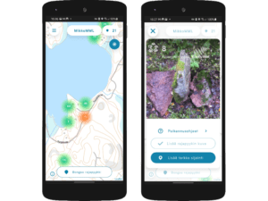
The reform will be visible not only in the topographic database but also on maps. Users will see the changes gradually over the coming years.
The reform is quite unique even on a global scale; to our knowledge, no similar solutions are in use elsewhere in Europe. Organisations responsible for land surveying generally use commercial solutions, but the use of open-source code is increasing, and many organisations are considering the wider adoption of open solutions.
“This has been a big step forward for us towards the future.”
– Risto Ilves, Head of Development, National Land Survey of Finland
‘We have developed a new model for cooperation in joint data modelling and data production. We are also expanding our cooperation with other authorities that use the same software stack. Cooperation in software development and maintenance extends the life cycle of the software and brings cost savings,’ says Jani Kylmäaho, Director of Development and Digitalisation at the National Land Survey of Finland.
Efficiency and independence
The system is built using a modular architecture, which allows for flexible development and procurement of technological solutions. This makes the system cost-effective and independent of individual suppliers. The reform will streamline the production processes for topographic data. Quality management tools have been developed to provide operators with direct feedback on errors that need correcting. The system also allows for the efficient utilisation of data from other data producers.
‘The reform is based on extensive modelling of topographic data carried out in collaboration with stakeholders, taking customer needs into account as far as possible. In practice, this means that the impact of NLS’s topographic data on society will increase further, particularly in analysis applications,’ says Risto Ilves.
Smoother cooperation
Updating the topographic database involves cooperation with several different stakeholders. Important partners include municipalities and energy companies.
‘Spatial data from other agencies and municipalities can now be compared and utilised directly, and the number of intermediate steps in data conversion has been reduced. As production processes and the application develop, manual steps in data processing will be further reduced through the introduction of more efficient automated runs and functions, according to MTTJ’s key users,’ says cartographer Matti Kivelä and Chief Specialist Iiro Försti.
The goal is to significantly reduce the manual processing and editing of partners’ data and to make the processes work ‘with the push of a button’.
The renewal was successful
A great deal of time was spent on planning to ensure a smooth transition to the new system. Although there have been occasional slowdowns and stability issues, the renewal has been technically successful.
The developers have closely monitored the system and acted quickly to resolve any issues that have arisen. In practice, production efficiency has increased rapidly since the implementation training.
‘Many surveyors are already producing more data than with the old system, which is a good indicator of the success of the implementation,’ says Risto Ilves.
Staff committed to change
Staff commitment to the renewal process has been key to its implementation. System users have actively sought to develop their skills, and new working methods are becoming part of everyday life. The success of the implementation is evident in the hundreds of tasks created and thousands of modifications added to the production database.
‘The development model used was very effective, as the process produced a functional system throughout. Key users were able to test the implemented features immediately and provide feedback on their functionality, which allowed us to focus on the aspects that were essential for the operation,’ says Risto Ilves. Overall, the National Land Survey is satisfied with the reform.
‘This has been a big step forward for us towards the future,’ Ilves sums up.