
Understanding Location Intelligence: Challenges and Considerations
In this article, we discuss some challenges and points to consider in the context of location intelligence.

In this article, we discuss some challenges and points to consider in the context of location intelligence.
The Geoinformatics Research Days event is the annual gathering for geoinformatics experts in Finland, which has been arranged by the member universities of the Finnish University Network for Geoinformatics (Fiuginet) for over 10 years.…

Course overview and motivation Are you working with geospatial data and running close to the limits of your own computing environment? Are you curious on how you can take your…

The Location Innovation Hub is Europe’s only centre of excellence focused on location information. LIH works with a largenetwork of partners. Operations started in early 2023. “Our goal at LIH…

These models can be viewed in the Land Survey of Finland’s File service of open data. They provide building owners with useful information that supports their energy renovations and adaptation to climate…
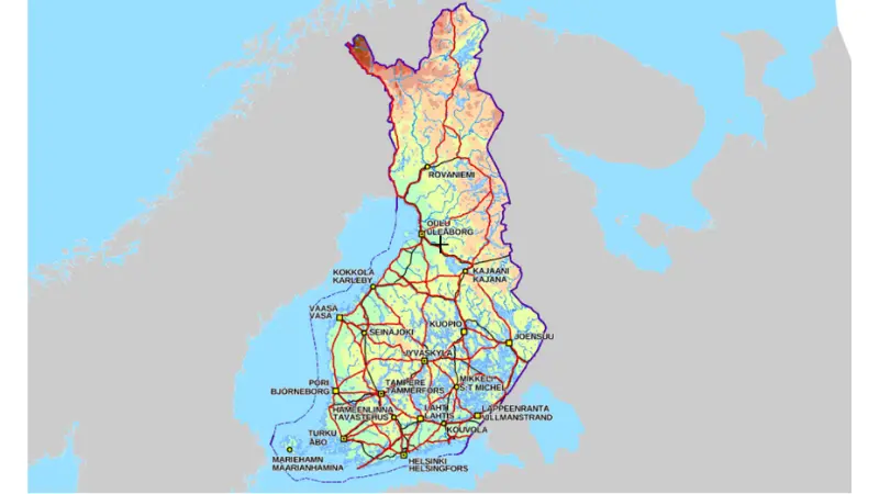
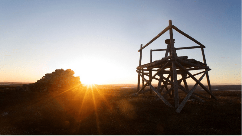
Finland’s geographical centre has been an area of interest before. While some have suspended an analogue cardboard model, some have tried to find the centre using mathematics. Because the calculation…

As one of the most environmentally friendly modes of travel, cycling plays an important role in designing sustainable urban mobility. In an ideal, cycling-friendly city, the infrastructure should allow cyclists…
Congratulations, you have received heritage! Not just any heritage, but World Heritage. You do not need to pay any inheritance tax or worry about registering the transfer of ownership. Since…

In Finland, several organisations have collected and maintained land use and land cover information for decades now. They have collected information from various sources using different methods, and this information…

Lidar remote sensing datasets have become commonplace tools for many archaeologists. In Finland, NLS datasets offer an excellent starting point in planning and conducting archaeological surveys. Elevation model data is…